2023-2026 Digital Navigator Internship Project
Students majoring or minoring in Geography, GIS, Environmental Science, Public Health, Criminal Justice, Computer Science, and related fields are participating in a three-year project, Tackling the Broadband Digital Equity Gap in Fitchburg, a Digital Equity Partnership with UMass Lowell led by Dr. Jane Huang.
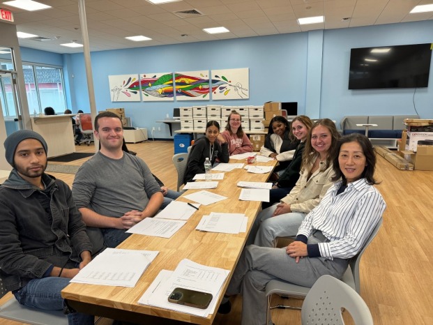
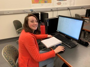
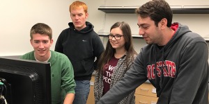
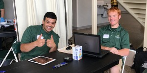
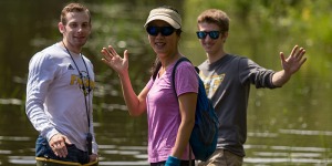
Through this paid internship program, students serve as Digital Navigators, delivering digital literacy training to youth and older adults at Fitchburg Youth Innovation Center, Joseph’s House, Armory Senior Center, and Making Opportunities Count (MOC). To date, more than two dozen student interns have trained over 100 participants, ranging in age from 12 to 94. See photos of our students in action.
Their work helps narrow the digital equity gap, build confidence and competence among individuals who have not kept pace with rapidly evolving technology, and enhance the quality of life for underserved community members. This community-focused initiative also supports the city and region in addressing critical challenges while expanding access to digital opportunities.
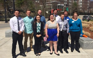
The program also provides meaningful professional development for student interns. Through teaching and lesson planning, they strengthen their communication, instructional, and leadership skills while gaining hands-on experience in community-based digital equity efforts. Each intern has had the opportunity to present their work at the campus-wide Undergraduate Conference; some have received awards, and others have represented the program at the statewide Undergraduate Conference.
2025 Student Presentations at International Conferences
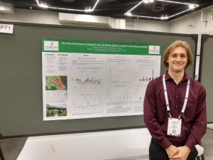
Ethan Chaco and Sara Beaulac presented at the American Geophysical Union (AGU) Conference in New Orleans in Dec 2025. Learn more about their summer research experiences.
Madison Ambrogi and Kate Messer presented at the Lunar and Planetary Science Conference in Houston in March 2025. Learn more about the interplanetary impact.
Summer 2026 - Lillian Maxwell REU at Woods Hole
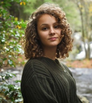
Lillian Maxwell is a junior Earth and Environmental Science major who has been awarded a student research fellowship at Woods Hole Oceanographic Institution for summer 2026. At WHOI she will be working in the Shackleton Lab on her own research project studying ancient polar ice cores. Although her exact project has not yet been decided, the overall goal of Shackleton lab is to use polar ice to understand the climate evolution of the planet.
Lillian transferred to Fitchburg State as a sophomore and is grateful for the opportunities she has been given since enrolling, which include a paid internship with Dr. Jane Huang and study abroad. She is confident that her experiences at Fitchburg State have prepared her for this next step in her education.
Previous Student Accomplishments
Fall 2023
Cole Brunker is a senior Environmental Biology major working with Dr. Elyse Clark examining the impacts of road salt applications on plant communities adjacent to roadways in the Fitchburg region. Cole sampled fifteen sites in the local area by identifying every plant within 50 meters of a road. Ten soil samples were collected from each of the fifteen sites and salt concentrations in the soils were measured. Cole is currently analyzing if there is a relationship between soil salt concentrations and the type of plants growing next to roadsides.
Spring 2023
Paulina Torres - GIS Internship with the Town of Shirley

Paulina took part in a GIS (Geographic Information System) internship with the Town of Shirley and their Open Space and Recreation Plan Committee. She learned various applications that GIS technology could be used in, and how it was valued for planning efforts during the internship. Her responsibilities included gathering GIS data from the town and public GIS sources and creating maps to be used in the town’s Open Space and Recreation Plan. The work done through this internship highlights the importance of GIS technology in town planning, and how it relates to other fields like conservation and environmental equity. This internship allowed her to grow GIS skill sets and gather an insightful understanding of a professional GIS workforce.
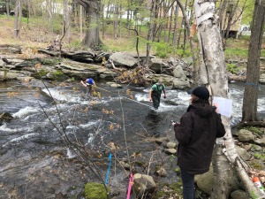
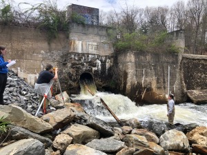
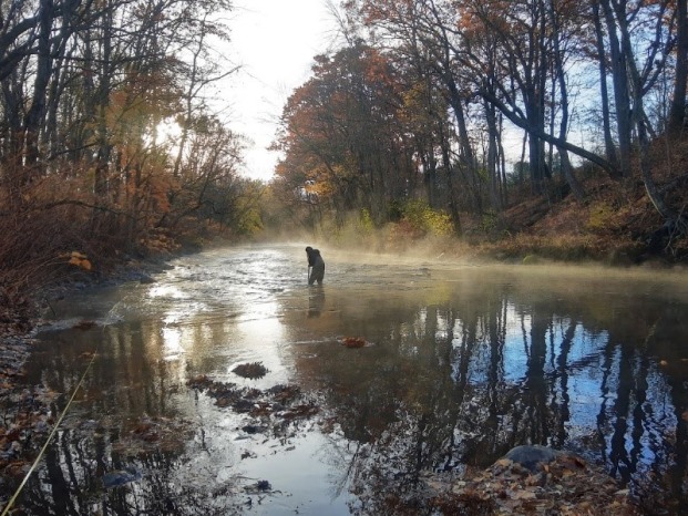
Geomorphology Class
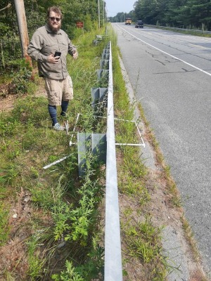
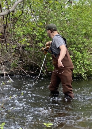
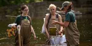
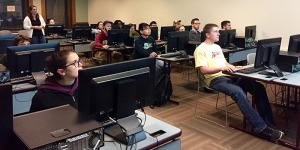
Below find photos from the Spring 2023 Geomorphology class where students are testing out survey equipment, measuring a stream width and cross section, and conducting a stream survey at a dam removal site in West Fitchburg.

Summer 2022 - Spring 2023
Kalli Brassard is a senior Environmental Biology major working with Dr. Elyse Clark examining the impacts of road salt applications on aquatic organisms in the North Nashua River. Kalli sampled eight different locations along the river using a net to collect the aquatic organisms living in the water. Samples were brought back to the lab and the organisms were identified and used to determined if the composition of the aquatic community may be impacted by road salt applications. Kalli presented her research at the Geological Society of America conference and the Fitchburg State University Undergraduate Research Conference in Spring 2023.
Other Student Stories
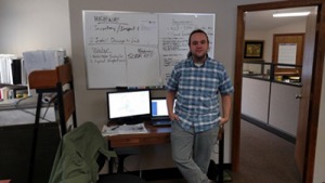
Taking a Bet on Fitchburg in Fitchburg State Magazine October 30, 2023 By Matthew Bruun. Tristan Taylor '17 is hoping to show the potential of a hyper-local internet service provider.
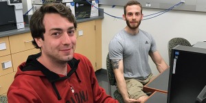
Students Collaborate on Mars research, NASA-funded internship yielded credits” which was published last summer. See more pictures.
Peter Lillie - Field Survey Projects using GIS and GPS Technologies
As a senior of the Geographic Science and Technology major, Peter had the opportunity to apply the geographic information system (GIS) and global position system (GPS) technologies to real-world survey projects through internship and independent study. Peter worked with WSP USA, an engineering company specializing in government work and high-level private-sector jobs, in winter 2022. Then he was involved in the Connecticut River Crossing Project with the city of Springfield, MA. His tasks focused on field surveys. In the spring 2022 semester, Peter worked with Dr. Jane Huang on the Environmental Mapping in Fitchburg project. He surveyed the downtown and the FSU neighborhood areas using GPS, logged waypoints of littering and plastic pollution, uploaded the survey points into a GIS, and produced maps of environmental concerns. The resulting maps could help the municipality clean up the city. The project also served as a forerunner of the Environment and GIS Mapping in Peru study abroad course that Dr. Huang led in May 2023.
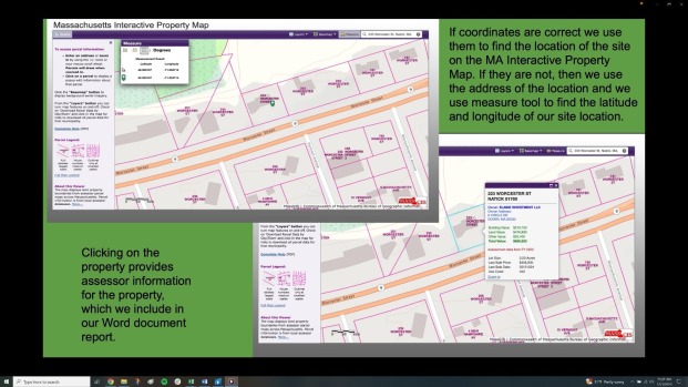
Martha Garley - MassDEP Brownfield Project
Martha worked as a geographic information system (GIS) intern for the Massachusetts Department of Environmental Protection (MassDEP). The tasks of her internship focused on organizing data and documenting brownfields, the previously developed land that is not currently in use and may be potentially contaminated. Martha used GIS to collect datasets and create maps, which allowed visualization and easy access to information. She also worked on comparing coordinates and details from brownfield reports to match with the corresponding property parcel maps. Martha’ work contributed to the MassDEP BWSC Brownfields Certification program, which identified and promoted the redevelopment of former disposal sites.
Robert Carpenter, who is supervised by Dr. Elyse Clark, presented his research on the impacts of road deicers on water quality of the North Nashua River at the National Geological Society of America meeting in Portland, Oregon. Robby’s project examines eight sites along the North Nashua River in the local area and includes water quality analyses and soil analyses.
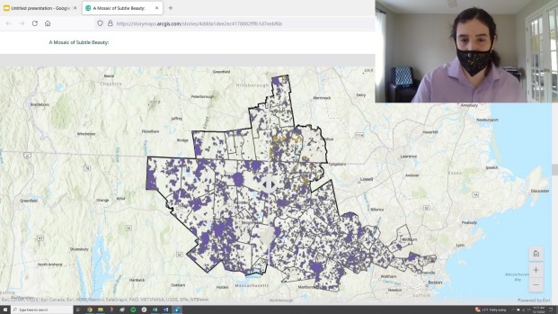
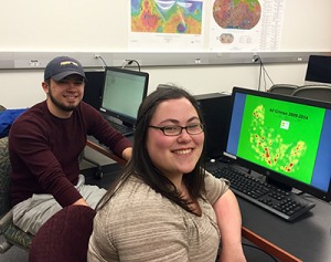
Aubrey Brennan and Daniel Richardson - Mapping Conserved Lands in the Freedom’s Way National Heritage Area
Aubrey and Daniel were research interns working with Dr. Jane Huang on a project with the Freedoms Way National Heritage Area, a federally designated area encompassing portions of northern Massachusetts and southern New Hampshire. The goal of the project was to support the “America the Beautiful - 30 by 30” initiative, which aims to conserve 30 percent of the nation’s land by 2030. Aubrey and Daniel had specific tasks that included updating and creating conserved lands maps using GIS (geographic information system) and developing online interactive mapping tools for the area. The internship provided them with hands-on practice with the processes of collecting, analyzing, and compiling GIS data, as well as applying the knowledge and skillsets learned in geography courses to a close-to-home real-world project.
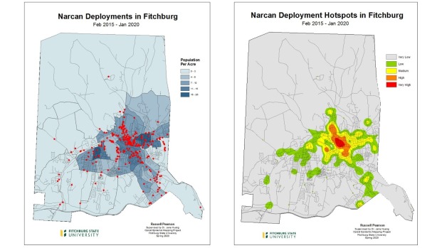
Russell Pearson - Mapping the Opioid Epidemic in Fitchburg
Russell worked with Dr. Jane Huang as a GIS intern. He conducted research on the Worcester County Overdose Death Response Initiative Project. The project was a joint research coordination with the Worchester District Attorney’s Office, the Geographic Science and Technology Program, and the Criminal Justice Program at Fitchburg State University. Russell focused on mapping the drug epidemic in the city of Fitchburg in a GIS (Geographic Information System). The Fitchburg Police Department provided datasets of overdose calls, Narcan deployments, overdose deaths, and arrests associated with drugs. These datasets were reformatted and geocoded to generate drug location maps. Further investigation of hotspots analysis was conducted to examine the spatial pattern of the drug crisis. This research endeavor helped improve the investigation and prosecution response to overdose deaths in Fitchburg.
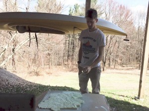
Sean Beverly – Internship of Designing and Printing a 3D Model of the Nashua River Watershed
The project was a collaboration between the Earth and Geographic Sciences and Industrial Technology Departments, and the Nashua River Watershed Association. Sean designed and constructed a 3D computer model of the Nashua River Watershed using GIS and other technologies in the geospatial research lab in the Earth and Geographic Sciences Department. The model was then sent to the Industrial Technology Department for 3D printing. One copy of the printed 3D model will be displayed at the River Resource Center at the Nashua River Watershed Association office. The project was a success both technically and in fostering partnerships between the University and the community-based organizations.

Jesse Corbin - GIS Internship with the Snowriders of the Nashaway
Jesse worked as a GIS Intern for the Snow-Riders of the Nashaway, a subgroup of the Snowmobile Association of Massachusetts (SAM). His main tasks were to collect trail data using a GPS unit and create both printable and online interactive trail maps in a GIS. Jesse hiked and occasionally rode on an offload vehicle with club members in the process of trail data collection. The collected GPS data was then downloaded and processed in a GIS to create a series of trail maps for the Snow-Riders. Jesse’s work was a big help to the maintenance and upkeep of the trails within the Nashaway/Wachusett region.
Caroline Anderson – GIS Internship of Mapping the Opioid Epidemic in Fitchburg
Caroline was involved in the Worcester County Overdose Death Response Initiative Project. The project is a joint research coordination with the Middle District Attorney’s Office, the Geographic Science and Technology Program, and the Criminal Justice Program at Fitchburg State. Caroline mainly focused on studying the drug epidemic in the city of Fitchburg. Numeric and spatial analyses were conducted in a GIS to examine the temporal and spatial pattern of the drug crisis. Caroline’s semester-long work laid a solid foundation for the two-year project.
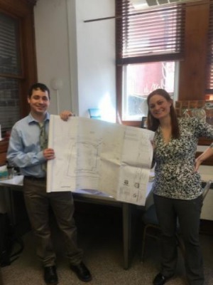
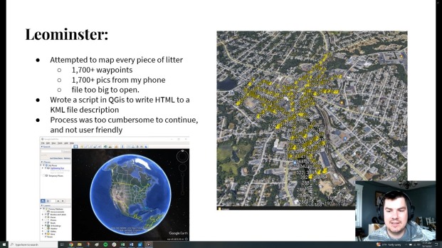
Ed Zink - Geography Internship with the Leominster Department of Planning and Development
Ed interned with the Planning Department at City Hall in Leominster, MA. Ed assisted the planning director and staff in analyzing and verifying subdivision and special permit applications, aided the transition to digitization through electronic record conversion, and incorporated GIS elements to the department. He also assisted the Assessors Department in updating the city zoning and overlaying maps using GIS and the Mayor’s office in organizing community outreach events. Ed was the first Public Planning intern at the Leominster City Hall and his work was very much appreciated.
Ed with his supervisor, Elizabeth Wood.
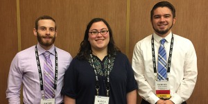
Two students presented at the New England Urban and Regional Information Systems Association Annual Conference
Sam Gallagher and Caroline Anderson presented at the New England Urban and Regional Information Systems Association (NEURISA) Annual Conference on Oct 15th, 2018 in Beverly MA. Their presentation, titled “GIS Analysis of Land Use and Potential Flooding in the Nashua River Watershed”, gave the audience an overview of the research projects they conducted in summer 2018.
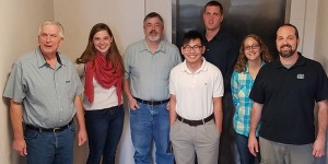
Two professors and three students in the department were involved in the 2018 Student-Faculty Collaborative Summer Research Experience Program
Samantha studied micro-plastic and the health of the Nashua River, supervised by Dr. Liz Gordon.
Using GIS, Sam Gallagher examined land use and land cover changes and Caroline Anderson simulated flooding in the Nashua River Watershed, supervised by Dr. Jane Huang
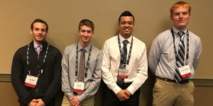
Timothy McLaughlin, Nicholas De Paula, Jacob Hogue, and Sean Beverly Presented at Regional GIS Conference
Tim, Nick, Jacob, Sean and Dr. Jane Huang were invited to present at the New England Urban and Regional Information Systems Association (NEURISA) Annual Conference on Oct 16th, 2017. Their presentation, titled “Studying Environmental and Public Health in the Fitchburg Area Using GIS”, gave the audience an overview of the research projects they conducted in summer 2017.
Jake Glick, Timothy McLaughlin, Sean Beverly, and Tallie Foster Working on Inventorying the Industrial and Commercial Properties in Fitchburg.
As a continuation of the Reimagine North of Main Neighborhood Revitalization Project, Jake, Tim, Sean, and Tallie helped the city inventory the industrial and commercial properties in Fitchburg. The inventory was performed through internet search, phone interview, and field survey. Once the inventory is completed, the properties will be mapped and analyzed in a GIS. The results will help the city understand the usages of the industrial and commercial properties and develop revitalization plans.
Two professors and six students in the department involved in the 2017 Student-Faculty Collaborative Summer Research Experience Program.
Tallie Foster and Kaitlin Berube studied sediment and the health of the Nashua River, supervised by Dr. Liz Gordon
Ali Wertheim, GIS internship at City of Gardner
Ali has been mapping the cemetery plots for the three public cemeteries in the City of Gardner. She’s linked the cemetery database, which is in MS Access, to the GIS data and resolved data issues to get to a 100% match rate. Resolution steps involve researching cards, field mapping, historical record research, and access database editing. Ali’s work has been very appreciated by the engineering department and cemetery department at the City of Gardner. Ali is supervised by Ms. Rachael Catlow, GISP, GIS Coordinator, City of Gardner. Ms. Catlow has been a guest speaker and a friend of the Earth and Geographic Sciences Department at Fitchburg State University.

Victoria Leblanc, GIS Internship at North County Land Trust (NCLT)
Victoria is helping to prepare multi-layered GIS maps in order to prioritize land parcels that NCLT would like to conserve in the future. Part of her tasks include identifying areas crossing town boundaries that may be of interest for an overall outreach to landowners, town boards, and commissions. Victoria’s work contributes to the NCLT’s long term strategic land conservation plan. Victoria is supervised by Ms. Jassy Bratko, Director of Land Protection at NCLT.
Six students presented at the 2017 Undergraduate Research and Creative Practice Conference.
- Jacob Hogue, Jake Glick (GIS Mapping of the Reimagine North of Main Project)
- Huy Vo (GIS Internships with MRPC and Ayer DPW)
- Tallie Foster (Climate Change in the Pacific Northwest)
- Samuel Gallagher (The Effects of Climate Change on the Philippines)
- Paige Harrington (The Effects of Climate Change on the Amazon Rainforest)
- Paige Harrington, Jacob Hogue (Electricity and Waste: Understanding Sustainability on Fitchburg State’s Campus)
Jacob Hogue and Jake Glick Working on the Reimagine North of Main Project
In this extended Crocker Center research project, Jacob and Jake conducted a series of mapping and analysis for the Reimagine North of Main Project in the Fitchburg area. Jacob and Jake used GIS and web-mapping tools for the project.
Huy Vo (center in white polo shirt), Class of 2018, and coworkers during his internship
GIS Web Mapping and Programming Internship with Montachusett Regional Planning Commission (Fitchburg).
Huy, majoring in Computer Science and minoring in GIS, works on GIS Web Mapping and Programming under the supervision of GIS/IT director Jason Stanton.
Huy uses JavaScript, HTML and CSS to improve the performance of MRMapper – a web mapping tool designed to aid decision making processes. He is also the initiator and the first president of the newly established GIS Club, which attracts students within and beyond the Earth and Geographic Sciences department.
Kayla Kress, Jacob Hogue, and Samuel Gallagher Presented at Regional GIS Professional Conference
Kayla, Jacob, and Sam presented their GIS research project along with Dr. Jane Huang at the New England Urban and Regional Information Systems Association (NEURISA) Annual Conference on November 14th, 2016.
They were the only student presenters at this regional GIS conference which was attended by over a hundred GIS professionals crossed the region.
They spoke about the GIS research conducted during their internships on the local community revitalization project, ReImagine North of Main. They also enjoyed the many questions, comments, and compliments from the audience following the presentation.
Timothy McLaughlin and Nicholas De Paula used GIS to improve public health in Fitchburg, supervised by Dr. Jane Huang
Jacob Hogue and Sean Beverly applied GIS in the study of the health of the Nashua River, supervised by Dr. Jane Huang
Fitchburg State GIS Night at Clark University
19 students participated to the GIS Club event: Fitchburg State Night at Clark University on Nov 17th, 2016.
The students worked on a Raster GIS workshop, which was to determine an area of maple trees to tap for maple syrup in Paxton, MA. They also listened to three presentations given by Clark graduate students in GIS.
It was a blast! The event was organized by Henry Mros, a GST graduate (2015) and currently a Master’s student in GIS at Clark University, and two GIS Club leaders: Huy Vo and Mark Guercio.
Several students in our department shined bright at our 2016 Undergraduate Research and Creative Practice Conference.
Students Jacob Hogue, Gary Van Bramer, and Devin Richardt, sponsored by Dr. Jane Huang on their project, "GPS Survey of Healthy-Heart Trails--A Service Learning Term Project of GEOG-2400," tied for third place among the oral presentations.
Robin Pike, also sponsored by Dr. Jane Huang, took top honors for his oral presentation: "GIS Internship with the Ayer Department of Public Works."
Kayla Kress, Class of 2016 and Samuel Gallagher, Class of 2019
Kayla and Sam assist our own Dr. Jane Huang on the community revitalization project Reimagine North of Main. They study the neighborhood properties through mapping and analysis using GIS.
Henry Mros, Class of 2015
Henry Mros is a recent Fitchburg State Geographic Science and Technology graduate who is now working toward a master's in Geographic Information Sciences at Clark University.
Henry returned to campus in 2016 to deliver a talk, titled “GIS After Undergrad,” where he spoke to current majors about his academic experiences in grad school and shared examples of his post-undergraduate work.
Robin Pike, Class of 2016
GIS Internship with Ayer Department of Public Works
Robin works closely with the DPW superintendent and the town engineer to produce digital maps of the town's infrastructure while also inspecting infrastructure in the field and creating mobile maps that can be accessed via tablets and devices.
Laura Leclerc, Class of 2016 and Tristan Taylor, Class of 2017
Land Conservation Internships with North County Land Trust (Leominster)
Laura and Tristan conduct GIS Inventorying of farmland in the region while monitoring properties and documenting violations to Conservation Restrictions using GPS and GIS.
Tyler Godin, Class of 2017
Transportation Geography Internship with Montachusett Regional Planning Commission (Fitchburg)
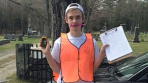
Tyler conducts traffic counts in 21 communities across the Montachusett region, surveys for the Heart Healthy Trail Project in several local communities, and studies walkability for the town of Lancaster.